
Vox clamantis in deserto


Dan O’Brien: Looking at heat islets in Boston

It was cooler then….

Boston Common is well-treed, making it the coolest place in the downtown “Hub,’’ except for the immediate coast when the wind is off the water.
From The Conversation, except for images above.
Dan O’Brien is a professor of public policy and urban affairs and director of the Boston Area Research Initiative at Northeastern University, in Boston.
He has received funding from the National Science Foundation's Smart & Connected Communities program for work.
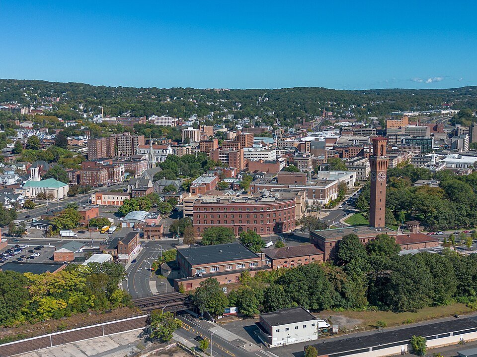
BOSTON
It’s summer, and it’s been hot, even in northern cities such as Boston. But not everyone is hit with the heat in the same way, even within the same neighborhood.
Take two streets in Boston at 4:30 p.m. on a recent day, as an example. Standing in the sun on Lewis Place, the temperature was 94 degrees Fahrenheit (34.6 degrees Celsius). On Dudley Common, it was 103 F (39.2 C). Both streets were hot, but the temperature on one was much more dangerous for people’s health and well-being.
The kicker is that those two streets are only a few blocks apart. The difference epitomizes the urban heat island effect, created as pavement and buildings absorb and trap heat, making some parts of the city hotter.
The shade of a few nearby trees doesn’t keep Dudley Common from heating up several degrees more than neighboring streets.
A closer look at the two streets shows some key differences:
Dudley Common is public open space sandwiched between two thoroughfares that create a wide expanse of pavement lined with storefronts. There aren’t many trees to be found.
Lewis Place is a residential cul-de-sac with two-story homes accompanied by lots of trees.
This comparison of two places within a few minutes’ walk of each other puts the urban heat-island effect under a microscope. It also shows the limits of today’s strategies for managing and responding to heat and its effects on public health, which are generally attuned to neighborhood or citywide conditions.
The top circle is Dudley Common. The bottom is Lewis Place, where trees keep the cul-de-sac several degrees cooler. Imagery ©2025 Airbus Maxar Technologies, map data Google ©2025
Even within the same neighborhood, some places are much hotter than others owing to their design and infrastructure. You could think of these as urban heat islets in the broader landscape of a community.
Sensing urban heat islets
Emerging technologies are making it easier to find urban heat islets, opening the door to new strategies for improving health in our communities.
While the idea of reducing heat across an entire city or neighborhood is daunting, targeting specific blocks that need assistance the most can be faster and a much more efficient use of resources.
Doing that starts with making urban heat islets visible.
In Boston, I’m part of a team that has installed more than three dozen sensors across the Roxbury neighborhood to measure temperature every minute for a better picture of the community’s heat risks, and we’re in the process of installing 25 more. The Common SENSES project is a collaboration of community-based organizations, including the Dudley Street Neighborhood Initiative and Project Right Inc.; university researchers like me who are affiliated with Northeastern University’s Boston Area Research Initiative; and Boston city officials. It was created to pursue data-driven, community-led solutions for improving the local environment.
Data from those sensors generate a real-time map of the conditions in the neighborhood, from urban heat islets like Dudley Common to cooler urban oases, such as Lewis Place.
Technologies are becoming increasingly affordable and are being deployed in communities around the world to pinpoint heat risks, including Miami, Baltimore, Singapore and Barcelona. There are also alternatives when long-term installations prove too expensive, such as the U.S.’s National Oceanic and Atmospheric Administration volunteer science campaign, which has used mobile sensors to generate one-time heat maps for more than 50 cities.
Cooler communities, block by block
Although detailed knowledge of urban heat islets is becoming more available, we have barely scratched the surface of how they can be used to enhance people’s health and well-being.
The sources of urban heat islets are rooted in development –- more buildings, more pavement and fewer trees result in hotter spaces. Many projects using community-based sensors aspire to use the data to counteract these effects by identifying places where it would be most helpful to plant trees for shade or install cool roofs or cool pavement that reflect the heat.
Workers in Los Angeles apply a cool pavement coating to reflect heat rather than absorbing it. John McCoy/MediaNews Group/Los Angeles Daily News via Getty Image
However, these current efforts do not fully capitalize on the precision of sensors. For example, Los Angeles’ massive investment in cool pavement has focused on the city broadly rather than overheated neighborhoods. New York City’s tree planting efforts in some areas failed to anticipate where trees could be successfully planted.
Most other efforts compare neighborhood to neighborhood, as if every street within a neighborhood experiences the same temperature. London, for example, uses satellite data to locate heat islands, but the resolution isn’t precise enough to see differences block by block.
In contrast, data pinpointing the highest-risk areas enables urban planners to strategically place small pocket parks, cool roofs and street trees to help cool the hottest spaces. Cities could incentivize or require developers to incorporate greenery into their plans to mitigate existing urban heat islets or prevent new ones. These targeted interventions are cost-effective and have the greatest potential to help the most people.
Comparing maps of New York’s vegetation and temperature shows the cooling effect of parks and neighborhoods with more trees. In the map on the left, lighter colors are areas with fewer trees. Light areas in the map on the right are hotter. NASA/USGS Landsat
But this could go further by using the data to create more sophisticated alert systems. For example, the National Weather Service’s Boston office released a heat advisory for July 25, the day I measured the heat in Dudley Common and Lewis Place, but the advisory showed nearly the entirety of the state of Massachusetts at the same warning level.
What if warnings were more locally precise?
On certain days, some streets cross a crucial threshold – say, 90 F (32.2 C) – whereas others do not. Sensor data capturing these hyperlocal variations could be communicated directly to residents or through local organizations. Advisories could share maps of the hottest streets or suggest cool paths through neighborhoods.
There is increasing evidence of urban heat islets in many urban communities and even suburban ones. With data showing these hyperlocal risks, policymakers and project coordinators can collaborate with communities to help address areas that many community members know from experience tend to be much hotter than surrounding areas in summer.
As one of my colleagues, Nicole Flynt of Project Right Inc., likes to say, “Data + Stories = Truth.” If communities act upon both the temperature data and the stories their residents share, they can help their residents keep cool — because it’s hot out there.
Ian Smith/Lucy Hutyra: To reduce summer heat in Boston and other big cities, think trees and white roofs
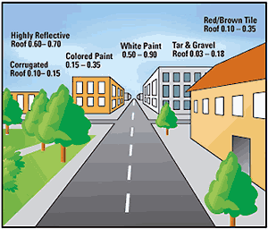
The albedo of several types of roofs (lower values means higher temperatures). Albedo means the proportion of the incident light or radiation that’s reflected by a surface.
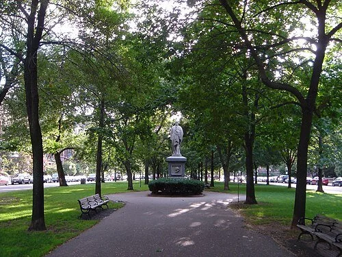
The famously well-treed Commonwealth Avenue Mall, in Boston’s affluent Back Bay section. Poorer sections in that city tend to have less tree density.
From The Conversation, except for images above.
Ian Smith is a research scientist in Earth & Environment at Boston University
Lucy Hutyra is a prrofessor & chairperson of the Earth and Environment Department at Boston University
Lucy Hutyra has received funding from the U.S. federal government and foundations, including the World Resources Institute and Burroughs Wellcome Fund, for her scholarship on urban climate and mitigation strategies. She was a recipient of a 2023 MacArthur Fellowship for her work in this area.
Ian Smith does not work for, consult, own shares in or receive funding from any company or organization that would benefit from this article, and has disclosed no relevant affiliations beyond their academic appointment.
BOSTON
When summer turns up the heat, cities can start to feel like an oven, as buildings and pavement trap the sun’s warmth and vehicles and air conditioners release more heat into the air.
The temperature in an urban neighborhood with few trees can be more than 10 degrees Fahrenheit (5.5 Celsius) higher than in nearby suburbs. That means air conditioning works harder, straining the electrical grid and leaving communities vulnerable to power outages.
There are some proven steps that cities can take to help cool the air – planting trees that provide shade and moisture, for example, or creating cool roofs that reflect solar energy away from the neighborhood rather than absorbing it.
But do these steps pay off everywhere?
We study heat risk in cities as urban ecologists and have been exploring the impact of tree-planting and reflective roofs in different cities and different neighborhoods across cities. What we’re learning can help cities and homeowners be more targeted in their efforts to beat the heat.
The wonder of trees
Urban trees offer a natural defense against rising temperatures. They cast shade and release water vapor through their leaves, a process akin to human sweating. That cools the surrounding air and reduces afternoon heat.
Adding trees to city streets, parks and residential yards can make a meaningful difference in how hot a neighborhood feels, with blocks that have tree canopies nearly 3 F (1.7 C) cooler than blocks without trees.
Comparing maps of New York’s vegetation and temperature shows the cooling effect of parks and neighborhoods with more trees. In the map on the left, lighter colors are areas with fewer trees. Light areas in the map on the right are hotter. NASA/USGS Landsat
But planting trees isn’t always simple.
In hot, dry cities, trees often require irrigation to survive, which can strain already limited water resources. Trees must survive for decades to grow large enough to provide shade and release enough water vapor to reduce air temperatures.
Annual maintenance costs – about US$900 per tree per year in Boston – can surpass the initial planting investment.
Most challenging of all, dense urban neighborhoods where heat is most intense are often too packed with buildings and roads to grow more trees.
How cool roofs can help on hot days
Another option is “cool roofs.” Coating rooftops with reflective paint or using light-colored materials allows buildings to reflect more sunlight back into the atmosphere rather than absorbing it as heat.
These roofs can lower the temperature inside an apartment building without air conditioning by about 2 to 6 F (1 to 3.3 C), and can cut peak cooling demand by as much as 27% in air-conditioned buildings, one study found. They can also provide immediate relief by reducing outdoor temperatures in densely populated areas. The maintenance costs are also lower than expanding urban forests.
Two workers apply a white coating to the roof of a row home in Philadelphia. AP Photo/Matt Rourke
However, like trees, cool roofs come with limits. Cool roofs work better on flat roofs than sloped roofs with shingles, as flat roofs are often covered by heat-trapping rubber and are exposed to more direct sunlight over the course of an afternoon.
Cities also have a finite number of rooftops that can be retrofitted. And in cities that already have many light-colored roofs, a few more might help lower cooling costs in those buildings, but they won’t do much more for the neighborhood.
By weighing the trade-offs of both strategies, cities can design location-specific plans to beat the heat.
Choosing right mix of cooling solutions
Many cities around the world have taken steps to adapt to extreme heat, with tree planting and cool roof programs that implement reflectivity requirements or incentivize cool roof adoption.
In Detroit, nonprofit organizations have planted more than 166,000 trees since 1989. In Los Angeles, building codes now require new residential roofs to meet specific reflectivity standards.
Workers plant a series of trees at the Coleman Young Community Center in Detroit in 2023. AP Photo/Carlos Osorio
In a recent study, we analyzed Boston’s potential to lower heat in vulnerable neighborhoods across the city. The results demonstrate how a balanced, budget-conscious strategy could deliver significant cooling benefits.
For example, we found that planting trees can cool the air 35% more than installing cool roofs in places where trees can actually be planted.
However, many of the best places for new trees in Boston aren’t in the neighborhoods that need help. In these neighborhoods, we found that reflective roofs were the better choice.
By investing less than 1% of the city’s annual operating budget, about US$34 million, in 2,500 new trees and 3,000 cool roofs targeting the most at-risk areas, we found that Boston could reduce heat exposure for nearly 80,000 residents. The results would reduce summertime afternoon air temperatures by over 1 F (0.6 C) in those neighborhoods.
While that reduction might seem modest, reductions of this magnitude have been found to dramatically reduce heat-related illness and death, increase labor productivity and reduce energy costs associated with building cooling.
Not every city will benefit from the same mix. Boston’s urban landscape includes many flat, black rooftops that reflect only about 12% of sunlight, making cool roofs that reflect over 65% of sunlight an especially effective intervention. Boston also has a relatively moist growing season that supports a thriving urban tree canopy, making both solutions viable.
In places with fewer flat, dark rooftops suitable for cool roof conversion, tree planting may offer more value. Conversely, in cities with little room left for new trees or where extreme heat and drought limit tree survival, cool roofs may be the better bet.
Phoenix, for example, already has many light-colored roofs. Trees might be an option there, but they will require irrigation.
Getting solutions where people need them
Adding shade along sidewalks can do double-duty by giving pedestrians a place to get out of the sun and cooling buildings. In New York City, for example, street trees account for an estimated 25% of the entire urban forest.
Cool roofs can be more difficult for a government to implement because they require working with building owners. That often means cities need to provide incentives. Louisville, Kentucky, for example, offers rebates of up to $2,000 for homeowners who install reflective roofing materials, and up to $5,000 for commercial businesses with flat roofs that use reflective coatings.
In Boston, planting trees, left, and increasing roof reflectivity, right, were both found to be effective ways to cool urban areas. Ian Smith et al. 2025
Efforts like these can help spread cool roof benefits across densely populated neighborhoods that need cooling help most.
As climate change drives more frequent and intense urban heat, cities have powerful tools for lowering the temperature. With some attention to what already exists and what’s feasible, they can find the right budget-conscious strategy that will deliver cooling benefits for everyone.