Those imaginative maps
Norman B. Leventhal Map & Education Center Collection / Boston and New England Maps / Mapping Boston Collection
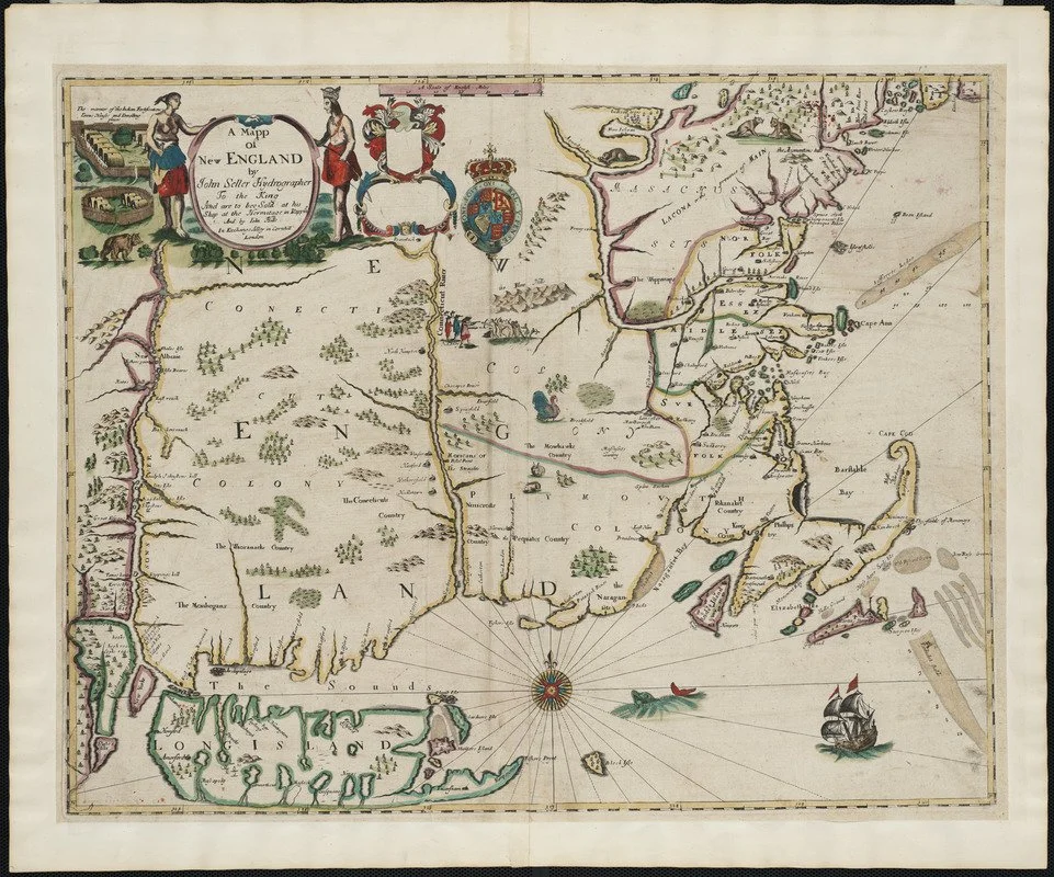
The center explains (we have edited slightly):
“This map is the firsy printed version of William Reed's original survey of 1665. The survey was commissioned by Massachusetts authorities to support the colonial boundaries as described in the first Massachusetts Charter of 1628. As originally proposed, the northern boundary was 30 miles north of the Merrimack River, assuming that the river followed an east-west course.
When it was later discovered that inland the Merrimack River turned north, Massachusetts colonists aggressively claimed lands 30 miles north of the river's source, an area also claimed by New Hampshire. The survey is the earliest to depict the relative position of the Hudson, Connecticut and Merrimack rivers. Also identified on the map are several towns that had been destroyed by Indians during the early months of King Philip's War.
Creator: